A Real-time Multimodal Transformer Neural Network-powered Wildfire Forecasting System
作者: Qijun Chen, Shaofan Li
分类: cs.LG, cs.AI
发布日期: 2025-03-07 (更新: 2025-03-12)
💡 一句话要点
提出一种基于多模态Transformer神经网络的实时野火预测系统
🎯 匹配领域: 支柱九:具身大模型 (Embodied Foundation Models)
关键词: 野火预测 多模态学习 Transformer神经网络 实时预测 环境灾害
📋 核心要点
- 现有野火预测方法难以有效融合多源异构数据,特别是地形和植被等小尺度信息,导致预测精度受限。
- 提出一种多模态Transformer神经网络,融合天气预报、地形和植被等多源数据,实现对野火发生概率的精准预测。
- 利用美国1992年至2015年的野火数据进行训练,该模型能够预测未来24小时内小区域的野火发生概率。
📝 摘要(中文)
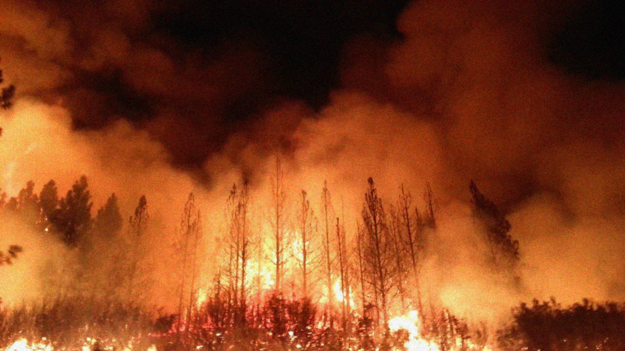
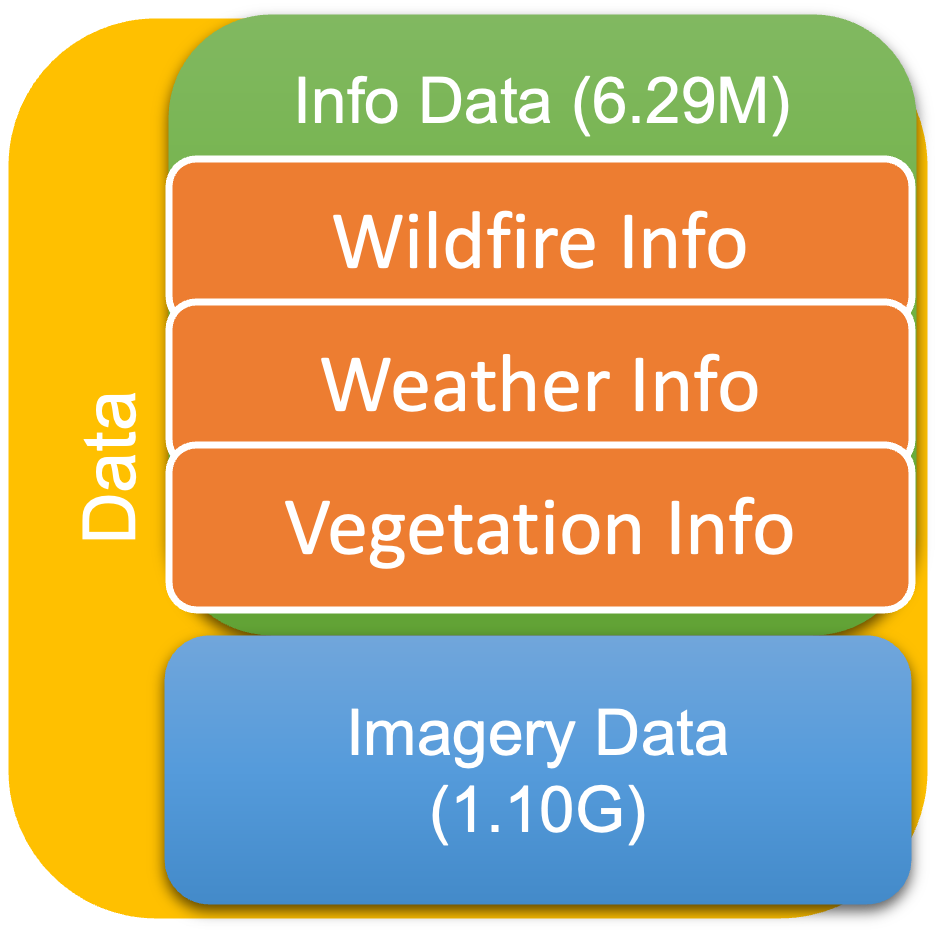
由于气候变化,极端野火已成为对人类文明最危险的自然灾害之一。野火的蔓延主要取决于环境因素,例如天气条件(温度、风向和强度、湿度)、当地植被的种类和数量以及地形条件。因此,准确预测野火的发生已成为全球范围内紧迫且艰巨的环境挑战。本文开发了一种实时的多模态Transformer神经网络机器学习模型,该模型结合了几种先进的人工智能技术和统计方法,以实际预测野火在精确位置实时发生的概率。该模型不仅利用了大规模数据信息(如每小时的天气预报数据),还考虑了小规模地形数据(如当地地形条件和从Google Earth图像收集的当地植被条件),以确定小规模野火发生位置的概率,并使其与天气预报信息同步。通过使用1992年至2015年美国野火数据训练多模态Transformer神经网络,该模型可以根据实时天气预报和同步的Google Earth图像数据预测野火发生的概率,从而提供未来24小时内任何小区域($100m^2$)内的野火发生概率。
🔬 方法详解
问题定义:论文旨在解决野火预测问题,现有方法难以有效融合天气、地形、植被等多源异构数据,导致预测精度不高,尤其是在小尺度区域的预测能力不足。现有方法通常依赖于单一数据源或简单的统计模型,无法充分捕捉野火发生的复杂影响因素。
核心思路:论文的核心思路是利用多模态Transformer神经网络,将天气预报数据、地形数据和植被数据进行有效融合,从而提高野火预测的准确性和精细度。Transformer模型具有强大的序列建模能力和注意力机制,能够捕捉不同数据源之间的关联性,从而实现更准确的预测。
技术框架:该系统主要包含数据预处理模块、多模态Transformer神经网络模型和预测结果输出模块。数据预处理模块负责对天气预报数据、地形数据和植被数据进行清洗、归一化等处理,使其能够被神经网络模型所接受。多模态Transformer神经网络模型是整个系统的核心,它将不同模态的数据输入到Transformer编码器中进行特征提取和融合,然后通过解码器预测野火发生的概率。预测结果输出模块将预测结果以可视化的方式呈现给用户。
关键创新:该论文的关键创新在于将多模态Transformer神经网络应用于野火预测领域,并成功地融合了天气、地形和植被等多源数据。与现有方法相比,该方法能够更有效地捕捉不同数据源之间的关联性,从而提高预测的准确性和精细度。此外,该模型还能够预测小尺度区域的野火发生概率,这对于野火防控具有重要的实际意义。
关键设计:论文中Transformer模型的具体结构未知,但可以推测其采用了多头注意力机制,以便捕捉不同数据源之间的复杂关系。损失函数可能采用了交叉熵损失函数,用于衡量预测结果与真实标签之间的差异。具体的训练参数设置未知,但可以推测其采用了Adam优化器,并设置了合适的学习率和batch size。
🖼️ 关键图片

📊 实验亮点
论文使用美国1992年至2015年的野火数据进行训练,并验证了模型的有效性。虽然论文中没有给出具体的性能数据和对比基线,但摘要中提到该模型能够预测未来24小时内任何小区域($100m^2$)内的野火发生概率,表明该模型具有较高的预测精度和精细度。具体的提升幅度未知。
🎯 应用场景
该研究成果可应用于野火风险评估、野火预警和野火防控等领域。通过提供精确的野火发生概率预测,可以帮助相关部门提前做好预防措施,减少野火造成的损失。此外,该系统还可以用于指导野火扑救工作,提高扑救效率,降低人员伤亡风险。未来,该技术有望推广到其他自然灾害预测领域。
📄 摘要(原文)
Due to climate change, the extreme wildfire has become one of the most dangerous natural hazards to human civilization. Even though, some wildfires may be initially caused by human activity, but the spread of wildfires is mainly determined by environmental factors, for examples, (1) weather conditions such as temperature, wind direction and intensity, and moisture levels; (2) the amount and types of dry vegetation in a local area, and (3) topographic or local terrian conditions, which affects how much rain an area gets and how fire dynamics will be constrained or faciliated. Thus, to accurately forecast wildfire occurrence has become one of most urgent and taunting environmental challenges in global scale. In this work, we developed a real-time Multimodal Transformer Neural Network Machine Learning model that combines several advanced artificial intelligence techniques and statistical methods to practically forecast the occurrence of wildfire at the precise location in real time, which not only utilizes large scale data information such as hourly weather forecasting data, but also takes into account small scale topographical data such as local terrain condition and local vegetation conditions collecting from Google Earth images to determine the probabilities of wildfire occurrence location at small scale as well as their timing synchronized with weather forecast information. By using the wildfire data in the United States from 1992 to 2015 to train the multimodal transformer neural network, it can predict the probabilities of wildfire occurrence according to the real-time weather forecast and the synchronized Google Earth image data to provide the wildfire occurrence probability in any small location ($100m^2$) within 24 hours ahead.